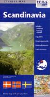
Scandinavia (Country map)
Grafik, karta. HEMA Maps. 2006.
Nyskick.
Synopsis
Road and travel map of Scandinavia (includes Denmark, Sweden, Finland, and Norway) with shaded relief in subtle colors. 2-sided folded paper map with protective card weight cover. Distinguishes 11 types of roads and shows road numbers and distances in kilometers. Scenic tourist routes are specially marked. Locates airports, railways, gliding sites, many towns and villages. With this map you can find scenic viewpoints, ancient sites and ruins, monuments, natural places, youth hostels, places to camp, tourist colonies, huts, and refuges, lighthouses, recommended beaches and hot springs, swimming places and spas. Inset city center maps of Trondheim, Oslo, Stockholm, Copenhagen, Gothenburg, and Malmo. Index of hundreds of named places. Legend in 8 languages including English. Scale 1:800,000.
**REMEMBER TO LOOK AT MY OTHER MAPS FOR SALE** You can order as many as you like for one shipping fee (within Sweden).