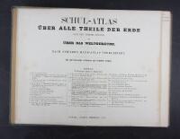
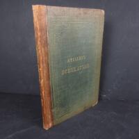
Schul-Atlas über alle theile der erde nach dem neuesten zustande und über das weltgebäude. Nach Stielers Hand-Atlas verkleinert. Acht und dreissigste verbessererte und vermehrte auflage
Grafik, karta.
Mycket gott skick.
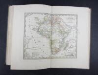
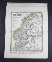
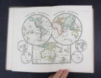
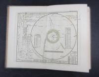
A classic high quality school atlas containing 32 hand coloured maps in outline. Including two world maps, the planetary system and a star map, Europe and its different countries are displayed on 17 maps. The rest shows Africa, North- and South America, Asia, the East Indies including India, western Asia with Iran and Saudi Arabia, USA, the West Indies and Australia with Polynesia. Moreover, two topographical maps of Europe and Asia depicting mountain ranges, lowlands and rivers
The german map publishing house Justus Perthes, (well known for producing the Stieler Hand-Atlas) was one of the world´s foremost map makers in the 19th century dominating the european market
Justus Perthes. Gotha 1858. (The first edition was published in 1821)
Title page with index + 32 map
Size: 25 x 17 cm
Light wear to the binding with bumbed corners. Faded front board with some spots. The maps are in fine condition