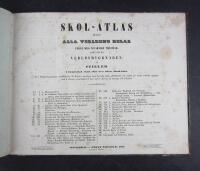
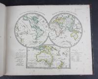
Skol-Atlas öfver alla verldens delar enligt dess nuvarande tillstånd, samt öfver verldsbyggnaden af Stieler i förminskad skala efter dess större Hand-Atlas
Grafik, karta.
Gott skick.
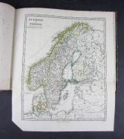
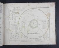
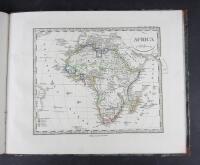
A classic high quality school atlas containing 31 hand coloured maps in outline. Including two world maps, the planetary system and a star map, Europe and its different countries are displayed on 21 maps, including a folding map of Scandinavia and for the present swedish edition an added map of Finland. The rest shows Africa, North- and South America, Asia, The East Indies including India, western Asia with Iran and Saudi Arabia, USA, and the West Indies. Moreover, tthere are two topographical maps of Europe and Asia depicting mountain ranges and rivers
This is a swedish edition of the german Stielers Schul-Atlas. The first swedish edition was published in 1825, and at least a dozen were issued up to 1855. The first german edition was published in 1821
The german map publishing house Justus Perthes, (well known for producing the Stieler Hand-Atlas) was one of the world´s foremost map makers in the 19th century dominating the european market
Adolf Bonnier Stockholm 1855
Title with index + 31 maps
Size: 24 x 29 cm
Light wear to the binding. Foxed maps and title